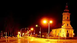
Grubišno Polje
Grubišno Polje (tjekkisk: Hrubečné Pole) er en by i Bjelovar-Bilogora distrikt i Kroatien.
| Grubišno Polje Hrubečné Pole | |
|---|---|
 | |
| Overblik | |
| Land |
|
| Postnr. |
43290 |
| Demografi | |
| Indbyggere |
5.367 (2021) |
| Andet | |
| Tidszone |
UTC+1 |
| Højde m.o.h. |
164 m |
| Hjemmeside | www.grubisnopolje.hr |
| Oversigtskort | |
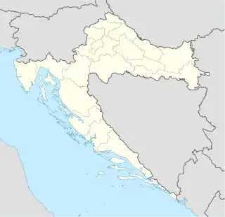 Grubišno Polje Grubišno Poljes beliggenhed i Kroatien 45°42′08″N 17°10′20″Ø | |
Historie
I slutningen af det 19. og begyndelsen af det 20. århundrede var Grubišno Polje en distriktshovedstad i Bjelovar-Križevci distrikt i Kongeriget Kroatien-Slavonien.
Seværdigheder
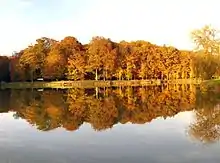
Bara udflugtssted
Byen har et mindesmærke for sine afdøde fra den kroatiske uafhængighedskrig.[1]
Bosættelser
Byens administrative område består af 24 bebyggelser (fra 2011), nemlig:
- Dapčevački Brđani, indb. 50
- Dijakovac, indb. 32
- Donja Rašenica, indb. 164
- Gornja Rašenica, indb. 89
- Grbavac, indb. 211
- Grubišno Polje, indb. 2.917
- Ivanovo Selo, indb. 264
- Lončarica, indb. 79
- Mala Barna, indb. 30
- Mala Dapčevica, indb. 3
- Mala Jasenovača, indb. 5
- Mala Peratovica, indb. 65
- Mali Zdenci, indb. 436
- Munije, indb. 35
- Orlovac Zdenački, indb. 285
- Poljani, indb. 261
- Rastovac, indb. 40
- Treglava, indb. 103
- Turčević Polje, indb. 44
- Velika Barna, indb. 335
- Velika Dapčevica, indb. 32
- Velika Jasenovača, indb. 58
- Velika Peratovica, indb. 26
- Veliki Zdenci, indb. 914
Referencer
- "Dan Grada Grubišno Polje (City Day of Grubišno Polje)". Arkiveret fra originalen 21. juli 2011. Hentet 23. november 2008.
- Officiel hjemmeside (kroatisk)
This article is issued from Wikipedia. The text is licensed under Creative Commons - Attribution - Sharealike. Additional terms may apply for the media files.