Brunnthal
Brunnthal er en kommune i Landkreis München (Oberbayern), i den tyske delstat Bayern. Den ligger på sletten Münchner Schotterebene, syd for delstatshovedstaden München.
| Brunnthal | |
| Våben | Beliggenhed |
 Coat of arms of Brunnthal |
 |
| Administration | |
| Land | |
|---|---|
| Delstat | Bayern |
| Admin. region | Oberbayern |
| Kreis | München |
| Borgmester | Stefan Kern (CSU) |
| Statistiske data | |
| Areal | 26,92 km² |
| Højde | 592 m |
| Indbyggere | 5.546 (31/12/2018) |
| - Tæthed | 206 Indb./km² |
| Andre informationer | |
| Tidszone | CET/CEST (UTC+1/UTC+2) |
| Nummerplade | M |
| Postnr. | 85649 |
| Tlf.-forvalg | 08102, 08104 |
| Koordinater | 48°1′N 11°41′Ø |
| Hjemmeside | www.brunnthal.de |
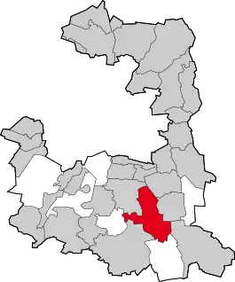
| Beliggenhed af kommunen Brunnthal i Landkreis München | |
 Kort | |
Brunnthal, Kirchstockach med Neukirchstockach, Waldbrunn og Gudrunsiedlung, Otterloh samt Hofolding og Faistenhaar er rydningsbebyggelser i Deisenhofener- og Hofoldinger Forst. Andre landsbyer i kommunenn er Englwarting, Portenläng og Riedhausen.
Kommunen har tidligere lagt navn til Autobahnkreuz München-Süd, der tidligere kaldtes „Brunnthal-Dreieck“ .
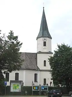
St. Nikolauskirken i Brunnthal
Eksterne henvisninger
This article is issued from Wikipedia. The text is licensed under Creative Commons - Attribution - Sharealike. Additional terms may apply for the media files.