Stearns County
Stearns County er et county i den amerikanske delstat Minnesota.
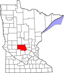
Stearns Countys placering i Minnesota.
Stearns County ligger i den centrale del af delstaten og grænser op til Todd County og Morrison County i nord, Benton County og Sherburne County i øst, Wright County i sydøst, Meeker County og Kandiyohi County i syd, Pope County i vest og Douglas County i nordvest.
Stearns Countys totale areal er 3.600 km² hvoraf 118 km² er vand. I 2000 havde amtet 133.166 indbyggere og administrationscentrum ligger i byen St. Cloud som også er største by i Stearns County.
Stearns County blev grundlagt i 1855 og har fået sit navn efter politikeren Charles Thomas Stearns.
This article is issued from Wikipedia. The text is licensed under Creative Commons - Attribution - Sharealike. Additional terms may apply for the media files.