East Ayrshire
East Ayrshire (skotsk: Aest Ayrshire; skotsk gælisk: Siorrachd Àir an Ear) er en af de 32 kommuner eller enhedslig myndigheder council areas i Skotland. Det grænser op til Dumfries and Galloway, East Renfrewshire, North Ayrshire, South Ayrshire og South Lanarkshire. Administrationscentret ligger på London Road, Kilmarnock.[1] Sammen med fastlandet i North Ayrshire dannede South Ayrshire det tidligere county Ayrshire.
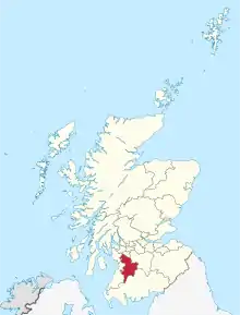
East Ayrshires placering i Skotland.
Den største skole i Skotland, Robert Burns Academy, ligger i Cumnock.[2]
Byer og landsbyer

Cumnock i East Ayrshires næststørste by.
- Afton Bridgend
- Auchinleck
- Bonnyton (tidligere landsby, ny i området Kilmarnock)
- Catrine
- Chapeltoun
- Corsehill
- Craigmalloch
- Cronberry
- Cumnock
- Dalmellington
- Dalrymple
- Darvel
- Drongan
- Dunlop
- Fenwick
- Galston
- Gatehead
- Glenbuck
- Greenholm
- Haugh
- Hurlford
- Kilmarnock
- Kilmaurs
- Knockentiber
- Lugton
- Mauchline
- Moscow
- Muirkirk
- Netherthird
- New Cumnock
- Newmilns
- Ochiltree
- Patna
- Polnessan
- Priestland
- Rankinston
- Riccarton
- Sorn
- Stair
- Stewarton
- Trabboch
- Waterside
Seværdigheder
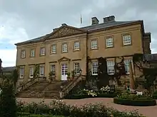
Dumfries House ligger i Cumnock
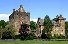
Dean Castle, Kilmarnock
- Aiket Castle
- Auchinleck House
- Dalmore House and Estate
- Dick Institute
- Loch Doon
- Loudoun Castle
- Kilmaurs Place
- Rowallan Castle
- Scottish Industrial Railway Centre
- Sorn Castle
- Stair House
- Dean Castle
- Tam O' Shanter Hone Works, Dalmore
- Robertland House
- Dumfries House
Referencer
Eksterne henvisninger
| | Spire Denne artikel om Skotlands geografi er en spire som bør udbygges. Du er velkommen til at hjælpe Wikipedia ved at udvide den. |
This article is issued from Wikipedia. The text is licensed under Creative Commons - Attribution - Sharealike. Additional terms may apply for the media files.