South Ayrshire
South Ayrshire (skotsk: Sooth Ayrshire; skotsk gælisk: Siorrachd Àir a Deas) er en af de 32 kommuner eller enhedslig myndigheder council areas i Skotland, og det dækker den sydlige del af Ayrshire. Det grænser op til Dumfries and Galloway, East Ayrshire og North Ayrshire. Området havde et estimeret indbyggertal i 2021 på 112.450.[1]
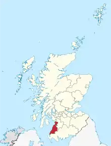
South Ayrshires placering i Skotland.
Byer og landsbyer
- Større byer
- Ayr
- Girvan
- Prestwick
- Troon
- Maybole
- Landsbyer og bebyggelser
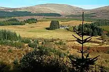
Landskab i South Ayrshire
- Alloway (forstad til Ayr)
- Annbank
- Ballantrae
- Barassie (forstad til Troon)
- Barr
- Barrhill
- Colmonell
- Coodham
- Coylton
- Craigie
- Crosshill
- Dailly
- Dundonald
- Dunure
- Failford[2]
- Joppa (forstad til Coylton)
- Kirkmichael
- Kirkoswald
- Lendalfoot
- Loans
- Maidens
- Monkton
- Mossblown
- Minishant
- Old Dailly
- Pinmore
- Pinwherry
- Straiton
- Symington
- Tarbolton
- Turnberry
Seværdigheder

Culzean Castle & Palm Garden, en stor turistattraktion i South Ayrshire
- Ailsa Craig
- Bachelor's Club, Tarbolton
- Bargany Gardens
- Blairquhan
- Burns Cottage
- Burns National Heritage Park (Robert Burns)
- Carrick Forest
- Crossraguel Abbey
- Culzean Castle
- Electric Brae
- Penkill Castle
- Souter Johnnie's Cottage
- Royal Troon Golf Club
- Turnberry Hotel and Golf Course
Referencer
- "Mid-2021 Population Estimates Scotland". National Records of Scotland. Hentet 29. december 2022.
- "Home". Destination South Ayrshire.
Eksterne henvisninger
| | Spire Denne artikel om Skotlands geografi er en spire som bør udbygges. Du er velkommen til at hjælpe Wikipedia ved at udvide den. |
This article is issued from Wikipedia. The text is licensed under Creative Commons - Attribution - Sharealike. Additional terms may apply for the media files.