North Ayrshire
North Ayrshire (skotsk gælisk: Siorrachd Àir a Tuath, Skabelon:IPA-gd) er en af de 32 kommuner eller enhedslig myndigheder council areas i Skotland. Det grænser op til Inverclyde mod nord, Renfrewshire og East Renfrewshire mod nordøst, og East Ayrshire og South Ayrshire mod hhv. øst og syd. Områdets lokalstyre er North Ayrshire Council, der blev dannet i 1996 med samme grænser som distriktet Cunninghame, som eksisterede fra 1975 til 1996.
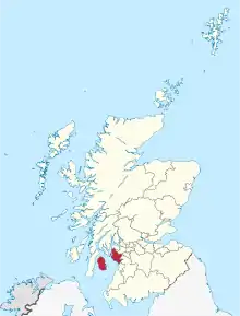
North Ayrshire ligger i central Lowlands med Firth of Clyde mod vest, og council-området dækker den nordlige del af det historiske county Ayrshire, samt øerne Arran og The Cumbraes fra det historiske county Buteshire.[1] North Ayrshire har omkring 135.280 indbyggere. De største bebyggelser er Irvine og Kilwinning.
Byer og landsbyer
Byer (fastlandet)
- Ardrossan
- Beith
- Dalry
- Irvine
- Kilbirnie
- Kilwinning
- Largs
- Saltcoats
- Stevenston
- West Kilbride
Landsbyer (fastlandet)

- Ardeer
- Auchentiber
- Barrmill
- Benslie
- Dreghorn
- Drybridge
- Fairlie
- Gateside
- Girdle Toll
- Glengarnock
- Longbar
- Skelmorlie
- Springside
- Stanecastle
Forstæder (fastlandet)
- Barkip
- Broomlands
- Bourtreehill
- Burnhouse
- Castlepark
- Crosbie
- Chapeltoun
- Cunninghamhead
- Dalgarven
- Drakemyre
- Eglinton
- Fergushill
- Fullarton
- Giffordland
- Greenhills
- Hessilhead hamlet
- Highfield
- Hunterston
- Kelburn
- Lawthorn
- Lylestone
- Meigle
- Meikle Auchengree
- Montgreenan
- Nettlehirst
- Perceton
- Portencross
- Routenburn
- Seamill
- Sevenacres
- Shewalton
- Torranyard
Landsbyer (Isle of Arran)

- Birchburn
- Blackwaterfoot
- Brodick
- Catacol
- Cladach
- Corrie
- Dippen
- Kildonan
- Kilmory
- Lagg
- Lamlash
- Lochranza
- Machrie
- Pirnmill
- Sannox
- Shiskine
- Sliddery
- Whitefarland
- Whiting Bay
Bebyggelser (Great Cumbrae)
- Millport
Seværdigheder
- Kelburn Castle
- Barrmill Park
- Clyde Muirshiel Regional Park
- Eglinton Country Park, Irvine
- Eglinton Tournament Bridge
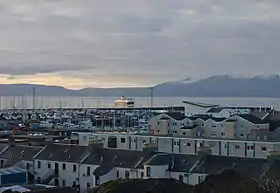
- Irvine Harbour
- Spier's Old School Grounds
Referencer
- "East coast, Firth of Clyde" (PDF). Arkiveret fra originalen (PDF) 2. april 2017. Hentet 16. december 2016.
Eksterne henvisninger
| | Spire Denne artikel om Skotlands geografi er en spire som bør udbygges. Du er velkommen til at hjælpe Wikipedia ved at udvide den. |